Raheny, Dublin, Ireland (Rath Éanna, Baile Átha Cliath, Éire)
Virtual Raheny - Touring Online
As you travel with us to see some parts of Raheny, click on any of the pictures, which are small on this page for ease of reading and to speed loading, for a larger view. All pictures have text alternates for slower connections and those with limited vision.
From the crossroads
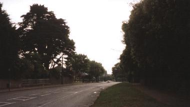
Coming out from Dublin city along the old Howth Road, we enter the modern district of Raheny at the crossroads 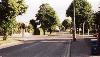 where four districts meet (Raheny on the east meets Killester to the west and both touch Clontarf to the south and Artane to the north). This was historically simply a direct road from Dublin City towards Howth, with the coastal and inland road connections added over the last century.
We look back from the crossroads into Killester 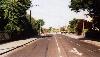 , whose church
  holds a relic of St. Brigid, second patron saint of Ireland. Then to our left we glance inland, to Artane
 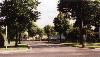 along Brookwood Avenue, a road which only came into being in the 1950's. Turning to our right, we look towards Clontarf
 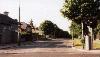 , with the region's Citizens Information Centre on our left. Heading down this road a little, we pass alongside St. Brigid's Boys National School and the Little Sisters' Sybil Hill Residence for the elderly
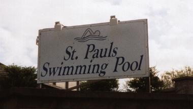
 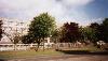 and turning back at the entrance to the main avenue of St. Anne's Park, we pass St. Paul's College and the site of St. Paul's Swimming Pool
 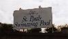 , now developed for housing.
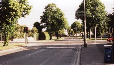
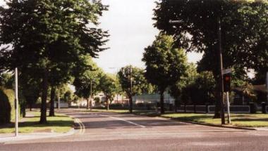
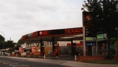
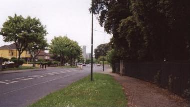
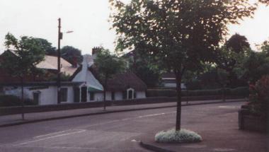
Back at the crossroads, we look into Raheny 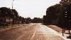 and moving forward, past the lands of Belfield, we reach on our left the first of Raheny's two service stations
 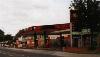 , where once stood Rosevale House, after which the adjoining apartment complex is named. Heading on, we pass over the Naniken River at the site of Ballyhoy Bridge (the bridge is now concealed under the road) and move past the entrance
 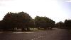 to St. Anne's
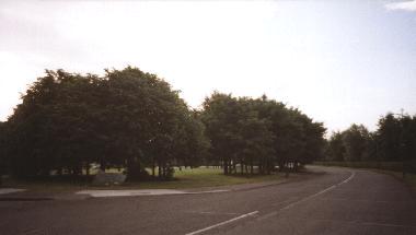
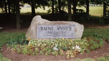
 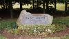 , a housing estate built by the city authorities on part of the St. Anne's Estate lands, the greater part of which now form St. Anne's Park, Dublin city's second largest municipal park (the biggest being nearby North Bull Island).
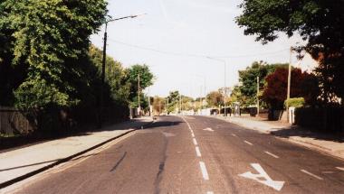
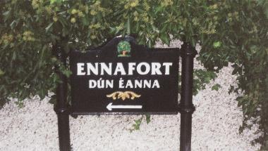
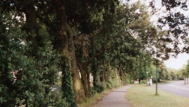
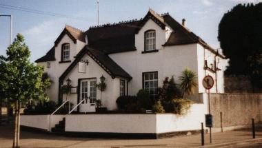
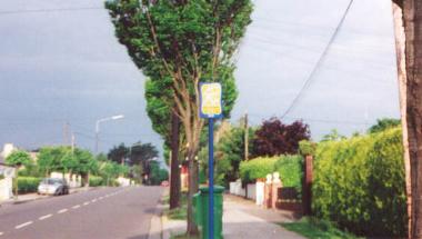
Going gently uphill now, we pass the former site of the Glebe House, home of Raheny's (Church of Ireland) Rectors for many years, and the access to Ennafort 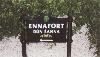 . This is also one way to Harmonstown DART station. On our right, the path and St. Anne's are sheltered by a range of bushes and then a tree avenue
 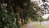 . To our left we will see Glena Lodge, with a modern rear extension larger than the house and then
 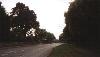 we reach the site of the house known successively as Ballyhoy, The Cottage and Raheny House, which, extended, now serves as a retirement home (formerly Dublin's Garda Retirement Home).
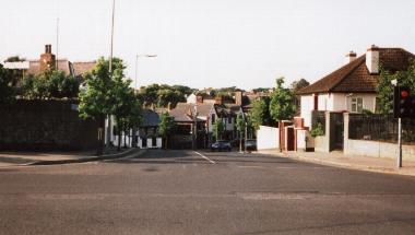
Into the village heart
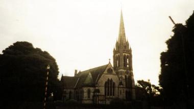
We are now looking towards the village centre  and moving on, we pass the beautiful
 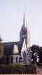 All Saints Church (CoI)
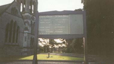
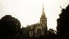 on our right
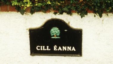
  , then its grounds, in which the current Rectory, Johnson Hall and the pleasant All Saints Lodge sit, and on our left Cill Eanna
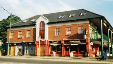
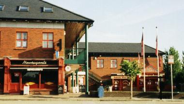
 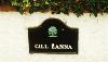 and then Raheny Gardens (now part of Howth Road), a cul de sac of houses built for ex-servicemen. We are now in the village centre, moving alongside Raheny Shopping Centre
 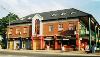 , whose main unit is the Supervalu Supermarket
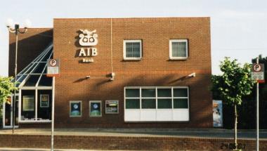
 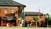 , with a large car park below, and in whose grounds AIB have their building
 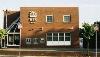 , on the banks of the Santry River. Meanwhile to our left is the older shopping precinct, with a range of commercial offerings and a car park
 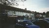 .
.
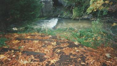
Crossing Raheny's main river, the Santry 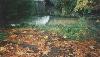 (discussed further on the Features page) on the recently remodelled bridge
 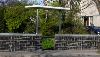 , we see on our left the old Church lands, with the Scout Den (73rd Unit C.S.I.)
  and its grounds
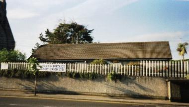
 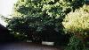 , which also host Raheny Shamrocks, a leading athletics club. Moving on and up to the village centre, we come to the former Credit Union building
  . St. Assam's Church, the former Catholic Parish Church,
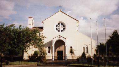
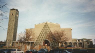
 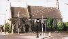 is now on its own plot and hosted St. Joseph's Youth Club for many years, before being sold to the Credit Union. Facing all these is the current Catholic Parish Church, that of Our Lady Mother of Divine Grace,
 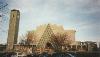 one of the dominant features of Raheny
 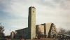 , in its broad grounds, including substantial car park
 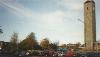 . The Credit Union (merged with those of Artane and Coolock in recent years) is temporarily housed in a building in church grounds. The church lands once held the Holy Well of St. Assam.
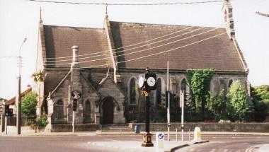
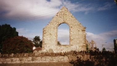
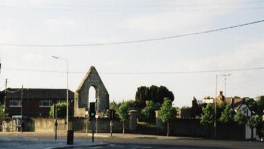
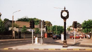
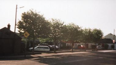
Diagonally opposite the new church are the ruins of old St. Assam's Church 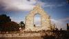 , the heart of the village.
 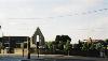 Within this site, which takes in the church and its graveyard, local tradition places a church for over a millennium, perhaps going all the way back to St. Assam or Assan himself! The crossroads between the churches is the centre of Raheny
 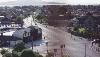 . Today it features the Millennium Clock
 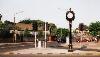 , added by the Raheny Business Association, Federation of Raheny Residents and others to celebrate 2000 and beyond. From here, we can look down into the old village
 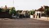 - this is Main Street, and links to the road to the coast and Bull Island. We can also see up to the railway station
 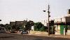 and beyond, and of course along the path of our tour, back towards the city and on towards Howth.
The rath (early fortress) from which Raheny takes its name lay under parts of all the items discussed in the previous two paragraphs, from the river across Howth Road and down Main Street and curving round the site of old St. Assam's. Exploratory digs during the 20th century uncovered substantial traces, though the earthen banks and stones were long since eroded for other local use. It is estimated the rath may have had a diameter of over a tenth of a kilometre.
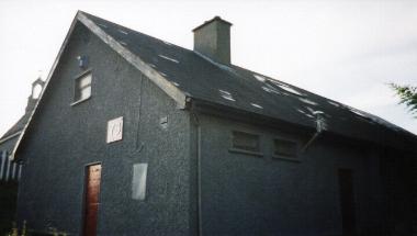
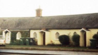
Just behind the old church and on the same "island" is the old schoolhouse 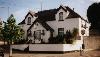 , built in 1787 by Samuel Dick, a well-to-do merchant who lived at Violet Hill (later Edenmore and now St. Joseph's Hospital). After Samuel Dick died (1801), this was funded by a Trust (the successor to which still exists) providing an income for "an endowment for a school in Raheny for poor children of all persuasions". This Trust's chief income was the profit from the rent on the eight sturdy cottages
 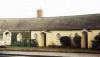 of Raheny's famous (and preserved) Crescent
 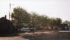 , which lies just up from the central crossroads. One house was sold with Court permission to fund some capital works on Springdale NS, but the rest remain rented from the Trust.
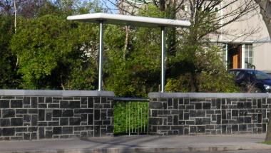
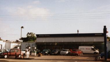
East of the old church is the Village Plaza, on which stands the Hayes Memorial Cross  . Opposite is the large Windsor Motors
 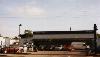 campus and then beyond on the right is Raheny Library
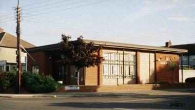
 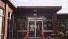 , ever popular with visitors from miles around. On the left we then come to the Bank of Ireland
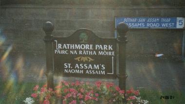
 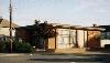 , at the entrance to St. Assam's and Rathmore Park
  , followed across the road by the former Post Office (later Spar), now a chemist with adjacent dog grooming and hardware
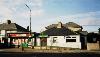 .
.
East to the coast and Howth
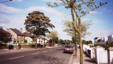
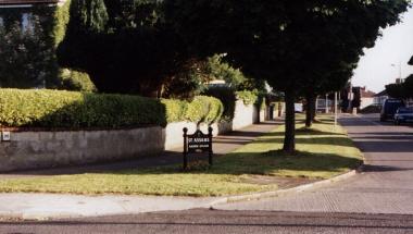
The road then sweeps on 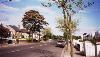 , passing a turn for Avondale and Maywood on the right, then one for St. Assam's and Foxfield on the left
 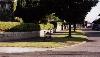 , which leads to the St. Assam's shops. Passing through a set of traffic lights, we are at the main entrance to Maywood and Bettyglen (Old Bettyglen - the new estate can only be reached from Watermill Road), to the left
 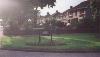 , which leads down tree-lined Maywood Road
 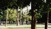 .
.
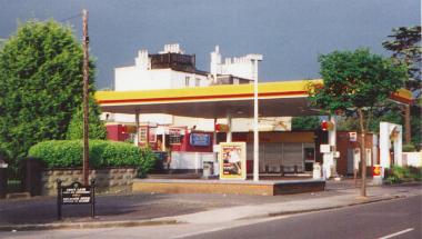
A little further along, there is the former Shieling Hotel 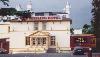 , a remnant of older days and until its closure the only hotel for quite a distance and Raheny's second service station, once known as Foxhall Service Station
 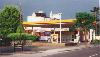 , later Topaz, just before the entrance to Orchard Road and Fox's Lane, once part of the main road
 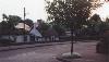 and the site of Raheny-by-the-Sea. Today it still hosts Raheny's surviving thatched cottage
 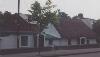 . Opposite is another entrance to Foxfield and just after, also on the left, the former Foxfield House, now called Berehaven. The road then crests and descends Blackbanks
 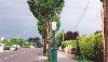 , passes a last turn for Foxfield and Kilbarrack and merges with the James Larkin coast road as Raheny draws to a close by the sea
 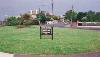 , facing Howth
 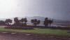 .
.
The road itself continues through Kilbarrack, past Bayside, and on to Sutton and then Howth, with a turn for the coastal route to Portmarnock and Malahide at Baldoyle.
|
Home |
Where are we? |
History |
Views |
Features |
Facilities, Shops etc. |
Religion |
Education |
Gazetteer |
Links |
Mail |
| © Copyright 1999 et seq. |
Last major update: August 2003 , last minor update: August 2018 |
Visits subject to the terms & conditions. |
 |
Skarl |
 where four districts meet (Raheny on the east meets Killester to the west and both touch Clontarf to the south and Artane to the north). This was historically simply a direct road from Dublin City towards Howth, with the coastal and inland road connections added over the last century.


